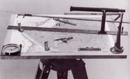
Qualification: Bachelor of "Land-utilization and Cadastral Register"
Short description: Students have a basic knowledge of the Land-utilization and Land Registry. They know the data structure and the process of renewal of Land Registry. They are familiar with the terminology used in the field and understand the basic legal acts.
Your future professional skills: Students are able to work on basic or advanced user level with the GIS software, which is used in the field of land consolidation design and Land Registry data processing (Microstation, import of Land Registry data into ArcGIS, Land Registry data viewers). They know and are able to apply a sequence of activities practiced in design of land consolidation projects.
Career options: There is a wide choice of jobs where people need to measure, mark, map and record boundary lines to define ownership and rights in real property (land, water, mineral, easements, rights-of-way, etc.), to resolve boundary disputes between neighbours, and for any subdivision of land, building development, road boundary realignment, etc.
Internship: Students pass industrial practices (internships) and educational practices in construction fields, oil and gas fields, drilling, oil and gas enterprises, companies of cadastral registration, research institutes, as well as in laboratories and university departments.
Reasons to study at Ukhta University: At USTU students get a good educational basic, taught by experienced lecturers and can get access to the university laboratories.
| Couse 1 |
ECTS |
| Philosophy |
3 |
| History |
3 |
| Foreign Language |
4 |
| Law |
2 |
| Mathematics |
8 |
| Computer Science |
3 |
| Physics |
4 |
| Environmental Studies |
2 |
| Material Studies |
2 |
| Life Safety |
3 |
| Geodesy |
5 |
| Psychology and Teaching |
2 |
| Chemistry |
4 |
| Mapping |
4 |
| Elective Courses (Units) on Physical Education and Sports |
|
| Management of Natural Resources |
4 |
| Ecological Mapping |
4 |
| Couse 2 |
ECTS |
| Foreign Language |
4 |
| Mathematics |
4 |
| Physics |
4 |
| Pedology and Geological Engineering |
3 |
| Geodesy |
3 |
| Photogrammetry and Remote Sensing |
3 |
| Engineering Provision of the Necessary Facilities on Site |
2 |
| Basics of Land-Utilization |
2 |
| Basics of Cadastral Register |
3 |
| Computers and Related Equipment |
2 |
| Land Law |
2 |
| Geographic Information Systems |
4 |
| Geochemical Basics of Pedology |
2 |
| Applied Geodesy |
5 |
| Elective Courses (Units) on Physical Education and Sports |
|
| Sociology and Political Science |
2 |
| Logics |
2 |
| Descriptive Geometry and Engineering and Computer Drawing |
3 |
| Topographical Drawing |
3 |
| Couse 3 |
ECTS |
| Economics |
3 |
| Typology of Property |
2 |
| Mapping |
2 |
| Economic and Mathematical Methods and Modelling |
3 |
| Engineering Provision of the Necessary Facilities on Site |
2 |
| Physical Education |
2 |
| Real Estate Economics |
3 |
| Geographic and Land Information Systems |
4 |
| Cadastral Register and Monitoring of Lands |
4 |
| Land-Utilization |
4 |
| Elective Courses (Units) on Physical Education and Sports |
|
| Real Estate Title Registration |
3 |
| Assessment of Property |
3 |
| Interfarm Land-Utilization System |
3 |
| Land Control |
3 |
| Zonal and Local Land-utilization |
3 |
| Planning of Land Utilization |
3 |
| Land Resources Management (Planning and Forecasting) |
5 |
| Organization and Perfomanse of Cadastral Register Work |
5 |
| Couse 4 |
ECTS |
| Metrology, Standartization and Sertification |
2 |
| Basics of Town and Country Planning |
2 |
| Legal Fundation of Land-Utilization and Cadastral Register |
2 |
| Mathematical Methods for Land-Uzing Modelling |
4 |
| Cadastral Register and Monitoring of Lands |
8 |
| Land-Utilization |
4 |
| Natural Resources Inventory |
4 |
| Data Support of Cadastral Register |
3 |
| Cadastral Register Application Programs |
3 |
| Inter-Farm Land Utilization System |
5 |
| Land Control |
5 |
| Photogrammetric Cadastral Data |
8 |
| Individual and Cadastral Valuation of Lands |
8 |


